Would you like to sign out?

Select Country

  • Afghanistan English
  • Albania English
  • Algeria English
  • American Samoa English
  • Andorra English
  • Angola English
  • Anguilla English
  • Antarctica English
  • Antigua and Barbuda English
  • Argentina Español
  • Armenia English
  • Aruba English
  • Australia English
  • Austria English
  • Azerbaijan English
  • Bahamas English
  • Bahrain English
  • Bangladesh English
  • Barbados English
  • Belarus English
  • Belgium English
  • Belize English
  • Benin English
  • Bermuda English
  • Bhutan English
  • Bolivia Español
  • Bosnia and Herzegovina English
  • Botswana English
  • Bouvet Island English
  • Brazil Español
  • British Indian Ocean Territory English
  • British Virgin Islands English
  • Brunei English
  • Bulgaria English
  • Burkina Faso English
  • Burundi English
  • Cambodia English
  • Cameroon English
  • Canada English
  • Cape Verde English
  • Caribbean Netherlands English
  • Cayman Islands English
  • Central African Republic English
  • Chad English
  • Chile Español
  • Christmas Island English
  • Cocos (Keeling) Islands English
  • Colombia Español
  • Comoros English
  • Congo English
  • Cook Islands English
  • Costa Rica Español
  • Côte d’Ivoire English
  • Croatia English
  • Cuba Español
  • Curaçao English
  • Cyprus English
  • Czech Republic English
  • Democratic Republic of the Congo English
  • Denmark English
  • Djibouti English
  • Dominica English
  • Dominican Republic Español
  • Ecuador Español
  • Egypt English
  • El Salvador Español
  • Equatorial Guinea English
  • Eritrea English
  • Estonia English
  • Ethiopia English
  • Falkland Islands English
  • Faroe Islands English
  • Fiji English
  • Finland English
  • France English
  • French Guiana Español
  • French Polynesia English
  • French Southern Territories English
  • Gabon English
  • Gambia English
  • Georgia English
  • Germany English
  • Ghana English
  • Gibraltar English
  • Greece English
  • Greenland English
  • Grenada English
  • Guadeloupe Español
  • Guam English
  • Guatemala Español
  • Guernsey English
  • Guinea English
  • Guinea-Bissau English
  • Guyana English
  • Haiti Español
  • Heard Island and McDonald Islands English
  • Honduras Español
  • Hong Kong English
  • Hungary English
  • Iceland English
  • India English
  • Indonesia English
  • Iran English
  • Iraq English
  • Ireland English
  • Isle of Man English
  • Israel English
  • Italy English
  • Jamaica English
  • Japan 日本語
  • Jersey English
  • Jordan English
  • Kazakhstan English
  • Kenya English
  • Kiribati English
  • South Korea 한국어
  • Kuwait English
  • Kyrgyzstan English
  • Laos English
  • Latvia English
  • Lebanon English
  • Lesotho English
  • Liberia English
  • Libya English
  • Liechtenstein English
  • Lithuania English
  • Luxembourg English
  • Macau English
  • Madagascar English
  • Malawi English
  • Malaysia English
  • Maldives English
  • Mali English
  • Malta English
  • Marshall Islands English
  • Martinique Español
  • Mauritania English
  • Mauritius English
  • Mayotte English
  • Mexico Español
  • Micronesia English
  • Moldova English
  • Monaco English
  • Mongolia English
  • Montenegro English
  • Montserrat English
  • Morocco English
  • Mozambique English
  • Myanmar English
  • Namibia English
  • Nauru English
  • Nepal English
  • Netherlands English
  • New Caledonia English
  • New Zealand English
  • Nicaragua Español
  • Niger English
  • Nigeria English
  • Niue English
  • Norfolk Island English
  • Northern Mariana Islands English
  • Norway English
  • Oman English
  • Pakistan English
  • Palau English
  • Palestine English
  • Panama Español
  • Papua New Guinea English
  • Paraguay Español
  • Peru Español
  • Philippines English
  • Pitcairn Islands English
  • Poland English
  • Portugal Español
  • Puerto Rico Español
  • Qatar English
  • Réunion English
  • Romania English
  • Russia English
  • Rwanda English
  • Saint Barthélemy Español
  • Saint Helena English
  • Saint Kitts and Nevis English
  • Saint Lucia English
  • Saint Martin Español
  • Saint Pierre and Miquelon English
  • Saint Vincent and the Grenadines English
  • Samoa English
  • San Marino English
  • Sao Tome and Principe English
  • Saudi Arabia English
  • Senegal English
  • Serbia English
  • Seychelles English
  • Sierra Leone English
  • Singapore English
  • Sint Maarten English
  • Slovakia English
  • Slovenia English
  • Solomon Islands English
  • Somalia English
  • South Africa English
  • South Georgia English
  • South Sudan English
  • Spain Español
  • Sri Lanka English
  • Sudan English
  • Suriname English
  • Svalbard and Jan Mayen English
  • Eswatini English
  • Sweden English
  • Switzerland English
  • Syria English
  • Taiwan English
  • Tajikistan English
  • Tanzania English
  • Thailand English
  • Togo English
  • Tokelau English
  • Tonga English
  • Trinidad and Tobago English
  • Tunisia English
  • Turkey English
  • Turkmenistan English
  • Turks and Caicos Islands English
  • Tuvalu English
  • U.S. Virgin Islands English
  • Uganda English
  • Ukraine English
  • United Arab Emirates English
  • United Kingdom English
  • United States of America English
  • U.S. Minor Outlying Islands English
  • Uruguay Español
  • Uzbekistan English
  • Vanuatu English
  • Vatican City English
  • Venezuela Español
  • Vietnam English
  • Wallis and Futuna English
  • Western Sahara English
  • Yemen English
  • Zambia English
  • Zimbabwe English
  • Åland Islands English
  • East Timor English
  • Netherlands Antilles English
  • Serbia and Montenegro English
  • North Macedonia English
  • Timor-Leste English
Geotechnical

[Free Tools] Maps of Isotherms Tool: Temperature Data Based on National Standards

Table of Contents Click the table of contents for details.


이벤트배너6


Hello, engineers interested in Eurocodes and structural design! Today, let's delve into the Maps of Isotherms tool, a powerful resource that provides maximum and minimum temperature data based on national standard codes. This tool is crucial for understanding and considering the effects of climatic conditions on design. For engineers working with Eurocode procedures, this feature is innovative in ensuring project performance and sustainability. Let's explore how the Maps of Isotherms tool operates, how to use it effectively, and its impact on design precision.


1. Role of the Maps of Isotherms Tool in Engineering


  1. Role of the Maps of Isotherms Tool in Engineering

Before we dive into the Maps of Isotherms tool, it is essential to understand the concept of isotherms. Isotherms are lines on a map that connect points with the same temperature over a specific time or period, represented visually on the map. In engineering and architectural design, accurate temperature data are critical for evaluating and optimizing various factors such as material performance, structural stability, thermal insulation, and building energy consumption.


Eurocode emphasizes the importance of considering climatic and environmental factors to design structures with durability and resilience. The Maps of Isotherms tool integrates precise temperature data provided by national standards, enabling designs tailored to the climatic conditions of specific regions. The supported regions include the UK, Ireland, Finland, the Czech Republic, Greece, and Belgium, ensuring location-specific and climate-appropriate designs.


2. How the Maps of Isotherms Tool Using


The Maps of Isotherms tool utilizes maximum and minimum temperatures from national standard codes to provide climate information for specific regions. This tool aids engineers and designers in understanding and predicting climate conditions for a given project location. Here is how it works:

1. Select a region on the Isothermal Contour Map.

2. Choose a code in the standard. 

3. Select the National Annex corresponding to the region.

map1

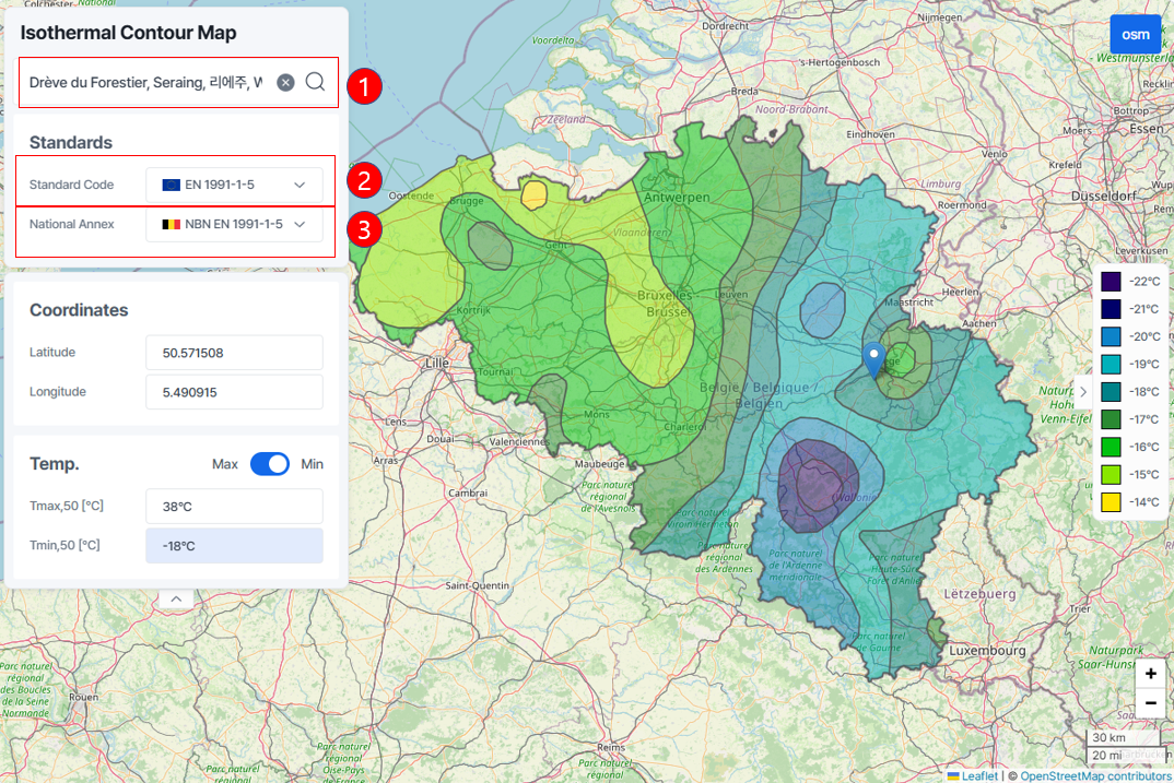
Once steps 1, 2, and 3 are set, you can view:

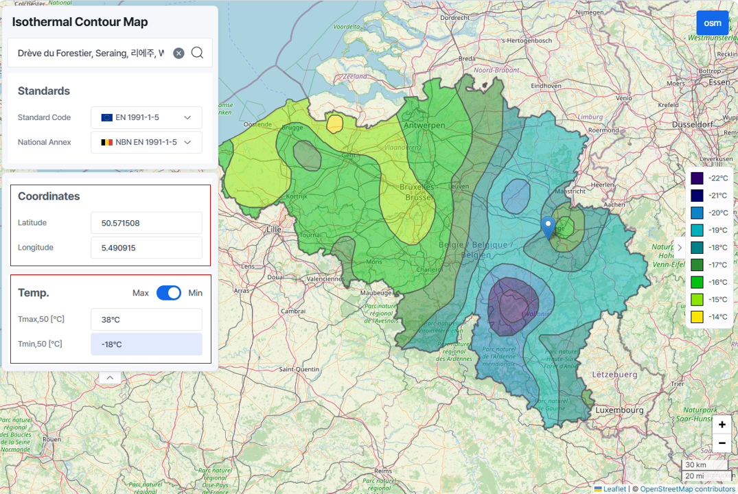
The latitude and longitude of the selected location in the Coordinates.

The maximum and minimum temperature data for the area in the Temp, displayed intuitively.

map2

3. Conclusion


The Maps of Isotherms tool is an invaluable resource for engineers utilizing Eurocodes. By providing maximum and minimum temperature data based on national standards, it supports critical design decisions that enhance performance, efficiency, and durability. Whether designing high-rise buildings, bridges, or industrial facilities, integrating precise climatic data is a fundamental aspect of achieving long-term success and sustainability.

That concludes our introduction to the Maps of Isotherms tool. We hope this tool proves useful for your projects!


4. Event


Free Maps of Isotherms tool Offer: Temperature Data Based on National Standards!
Hello, design professionals!
Today, we are excited to introduce a special opportunity to explore Maps of Isotherms, a powerful tool for environmental and structural design, completely free!
With this tool, you can quickly and accurately access maximum and minimum temperature data based on national standard codes. 


이벤트배너6


Subscribe to Newsletter

Catch the weekly engineer news!

What you may
also like